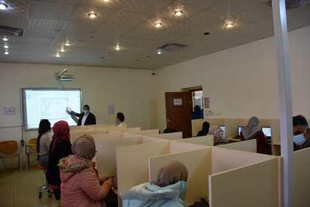
The Advisory Office at the College of Arts has organized a free training course entitled “Scientific foundations of geographic information systems” at the laboratory of the department of geography. The course aimed to clarify the work of collection, introduction, processing, analysis, presentation and output of spatial and descriptive information for specific purposes, and to help with planning and decision-making with regard to agriculture, city planning and housing expansion. The course included reading, revising, storing, retrieving, inquiring and analyzing the geographical infrastructure of any city (maps, aerial images, space visuals, descriptive names and tables) in addition to processing and analyzing spatial and statistical analysis on a computer screen or on paper in the form of reports maps, graphs or via the website.
Related Posts


Comments are disabled.