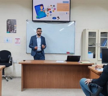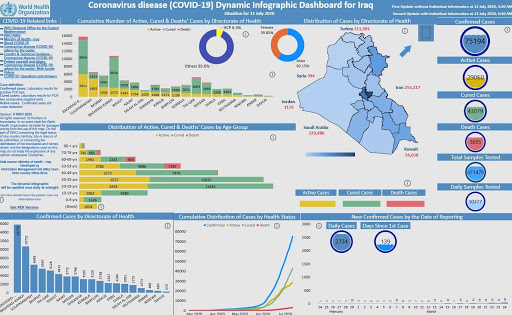
The remote sensing unit, in collaboration with Ibn Sina unit for e-learning and the continuing education unit at the college of science has organized a virtual symposium entitled “Crisis and disaster management and how to control Covid-19 pandemic by remote sensing techniques” presented by the Assist. Prof. Dr. Fouad Kazim Mashi, Assist. Lecturer Ali Abdul Nabi and Assist. Lecturer Ali Obeid, with the participation of a number of students, professors and physicians. The aim of the symposium is to identify the reasons behind the outbreak of Covid-19 in Iraq, which necessitated the establishment of a crisis management cell from all sectors in the country to facilitate containment and treatment plans by the use of some technical tools to identify the infected individuals by simulated reality based on spatial and metadata tabulated and projected in GIS maps.
The lecturers at first addressed the application of statistical theories and methods in the analysis of geospatial data, by providing a simulation model of the regions that witnessed epidemic infections through spatial analysis of geographical data, indicating that these apps provide all significant information on the ability to control contagious diseases by determining their location and ideal limits to apply sanitary isolation immediately. They even noted that the geographic information system (GIS) has provided electronic presentation slides needed for preparing reports that help the Iraq’s Crisis Cell to make relevant resolutions to protect people from the affected areas.